
Compass | Electronics
Active Filters
Electronics
Suggestions for Compass | Electronics
Beam compass Compass case Deck compass Mini compass Compass pouch Field compass Naval compass Silva compass Trail compass Wrist compass Hiking compass Marine compass Mirror compass Pocket compass Suunto compass Brunton compass Compass divider Compass lanyard Digital compass Drawing compass Pendant compass Aviation compass Binnacle compass Cammenga compass Drafting compass Fluxgate compass Gimbaled compass Handheld compass Keychain compass Lensatic compass Magnetic compass Military compass Nautical compass Sighting compass Surveyor compass Survival compass Baseplate compass Carabiner compass Mariner's compass Prismatic compass

Samsung Galaxy SmartTag 2 EI-T5600, a 4 pack of item finders with black and white options. Locate misplaced items easily using the connected app. Bluetooth range up to 120m. Lightweight and durable design. Works with both Android and iOS devices.
Samsung Galaxy SmartTag 2 EI-T5600, a 4 pack of item finders with black and white options. Locate misplaced items easily using the connected app. Bluetooth range up to 120m. Lightweight and durable design. Works with both Android and iOS devices.
Samsung Galaxy SmartTag 2 EI-T5600, a 4 pack of item finders with black and white options. Locate misplaced items easily using the connected app. Bluetooth range up to 120m. Lightweight and durable design. Works with both Android and iOS devices.

Classic ruler compass with griffigen DryFlex dose and integrated magnifying glass. - Scale for declination compensation is located within the capsule - With fluorescent elements, mm scale, and an optional safety strap - Waterproof in accordance with IPX8
Classic ruler compass with griffigen DryFlex dose and integrated magnifying glass. - Scale for declination compensation is located within the capsule - With fluorescent elements, mm scale, and an optional safety strap - Waterproof in accordance with IPX8
Classic ruler compass with griffigen DryFlex dose and integrated magnifying glass. - Scale for declination compensation is located within the capsule - With fluorescent elements, mm scale, and an optional safety strap - Waterproof in accordance with IPX8

The Silva Pocket Compass is a small and lightweight compass designed for outdoor enthusiasts. It features a durable construction, easy-to-read dial, and a built-in carabiner clip for convenient attachment to clothing or gear.
The Silva Pocket Compass is a small and lightweight compass designed for outdoor enthusiasts. It features a durable construction, easy-to-read dial, and a built-in carabiner clip for convenient attachment to clothing or gear.
The Silva Pocket Compass is a small and lightweight compass designed for outdoor enthusiasts. It features a durable construction, easy-to-read dial, and a built-in carabiner clip for convenient attachment to clothing or gear.

The Silva Map Measurer Path is a versatile tool designed for measuring distances and calculating navigation routes on maps. Its black rubber handle provides a comfortable grip, while its one-size design ensures it fits most hands.
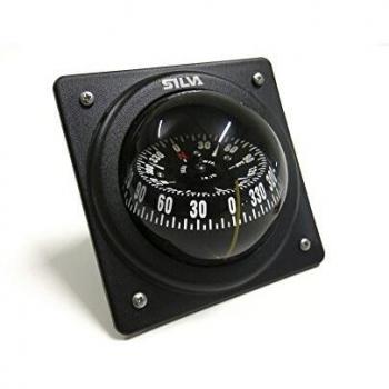
The SILVA 70P Kayak Compass is a reliable and precise 70mm bulkhead compass designed for marine navigation, offering easy installation with its unique pivot-mount system.
The SILVA 70P Kayak Compass is a reliable and precise 70mm bulkhead compass designed for marine navigation, offering easy installation with its unique pivot-mount system.

A versatile, lightweight compass featuring a 360‑degree graduated bezel and dual‑scale markings for 1:25 000 and 1:50 000 maps, ideal for hikers, trekkers, or military use.

High‑performance, waterproof 7×50 binoculars with a durable black housing and a clear blue lens coating for crisp night vision. Ideal for marine, hiking or wildlife viewing, offering wide field of view and long eye relief.

Technoline (4029665130507 / EA 3050)
Technoline (4029665130507 / EA 3050)

Steiner (4015649000706 / 7145) - Carrying Case - Suitable for eyeglass wearers - Closest focusing distance: 2 m - Depth: 95 mm - Exit pupil: 4.3 mm - Eye relief: 20 mm - Field of view (at 1000 m): 123 m | Table select & Function title

Full size base plate Non-slip silicon feet on base plate Romer scales: 1:25.000, 1:40.000, 1:50.000Inch scale Millimetre ruler Luminous markings for night navigation magnifier
Full size base plate Non-slip silicon feet on base plate Romer scales: 1:25.000, 1:40.000, 1:50.000Inch scale Millimetre ruler Luminous markings for night navigation magnifier

GPS Handheld device with 2.2-inch sunlight-readable colour display and preloaded with Topo Active maps with routable roads and trails for cycling and hiking - Support for GPS and GLONASS satellites allows for tracking in more challenging environments than
GPS Handheld device with 2.2-inch sunlight-readable colour display and preloaded with Topo Active maps with routable roads and trails for cycling and hiking - Support for GPS and GLONASS satellites allows for tracking in more challenging environments than
GPS Handheld device with 2.2-inch sunlight-readable colour display and preloaded with Topo Active maps with routable roads and trails for cycling and hiking - Support for GPS and GLONASS satellites allows for tracking in more challenging environments than
GPS Handheld device with 2.2-inch sunlight-readable colour display and preloaded with Topo Active maps with routable roads and trails for cycling and hiking - Support for GPS and GLONASS satellites allows for tracking in more challenging environments than
GPS Handheld device with 2.2-inch sunlight-readable colour display and preloaded with Topo Active maps with routable roads and trails for cycling and hiking - Support for GPS and GLONASS satellites allows for tracking in more challenging environments than
GPS Handheld device with 2.2-inch sunlight-readable colour display and preloaded with Topo Active maps with routable roads and trails for cycling and hiking - Support for GPS and GLONASS satellites allows for tracking in more challenging environments than
GPS Handheld device with 2.2-inch sunlight-readable colour display and preloaded with Topo Active maps with routable roads and trails for cycling and hiking - Support for GPS and GLONASS satellites allows for tracking in more challenging environments than
GPS Handheld device with 2.2-inch sunlight-readable colour display and preloaded with Topo Active maps with routable roads and trails for cycling and hiking - Support for GPS and GLONASS satellites allows for tracking in more challenging environments than
GPS Handheld device with 2.2-inch sunlight-readable colour display and preloaded with Topo Active maps with routable roads and trails for cycling and hiking - Support for GPS and GLONASS satellites allows for tracking in more challenging environments than
GPS Handheld device with 2.2-inch sunlight-readable colour display and preloaded with Topo Active maps with routable roads and trails for cycling and hiking - Support for GPS and GLONASS satellites allows for tracking in more challenging environments than
GPS Handheld device with 2.2-inch sunlight-readable colour display and preloaded with Topo Active maps with routable roads and trails for cycling and hiking - Support for GPS and GLONASS satellites allows for tracking in more challenging environments than
GPS Handheld device with 2.2-inch sunlight-readable colour display and preloaded with Topo Active maps with routable roads and trails for cycling and hiking - Support for GPS and GLONASS satellites allows for tracking in more challenging environments than
GPS Handheld device with 2.2-inch sunlight-readable colour display and preloaded with Topo Active maps with routable roads and trails for cycling and hiking - Support for GPS and GLONASS satellites allows for tracking in more challenging environments than

Dry Flex Rubber Bezel - Improved comfort and grip - Removable safety lanyard
Dry Flex Rubber Bezel - Improved comfort and grip - Removable safety lanyard
Dry Flex Rubber Bezel - Improved comfort and grip - Removable safety lanyard

The National Geographic Compass has a robust housing, a floating 360° scale and a north arrow. - The compass sheet is also equipped with a centimeter and measure scale. The sighting wire and slot make it possible to target land objects. - An lug is attac
Filters