
Digital map data
Suggestions for Digital map data

Explore the historic coast of Romney Marsh with this detailed Ordnance Survey Explorer Active Map 125.

Explore the vibrant streets of Glasgow and surrounding towns with this waterproof Ordnance Survey Explorer Active Map 342 – perfect for hikers, commuters, and history lovers seeking detailed, reliable navigation.

Explore the heart of Berkshire with Ordnance Survey’s Waterproof Explorer Active Map 159 – detailed coverage of Reading, Wokingham & Pangbourne. Ideal for hikers, cyclists, and local enthusiasts seeking accurate topography and navigation.

Explore the lush trails of Thetford Forest with the OS Explorer Active Map 229 – waterproof, weather‑proof, and packed with detailed topography for hikers, walkers, and nature lovers alike.

Explore the stunning landscapes of Northallerton, Ripon, Pateley Bridge and Leyburn with this waterproof Ordnance Survey Landranger Active Map 99. Ideal for hikers, cyclists and outdoor enthusiasts seeking reliable navigation in rugged terrain.

Explore the rolling hills of Shepton Mallet and Mendip in detail with OS Explorer Active Map 142—waterproof, weather‑resistant, and perfect for hiking, walking or local navigation. Includes a digital version for on‑the‑go access.

Explore the Thames Estuary with OS Landranger Active Map 178—waterproof, weatherproof, perfect for walking, cycling, or fishing around Rochester & Southend-on-Sea. Includes digital version for modern navigation.

Explore the heart of South Wales with OS Landranger 171 – a detailed paper map covering Cardiff, Newport, and Pontypool. Ideal for hikers, cyclists, and outdoor enthusiasts seeking accurate navigation and scenic routes.

Explore the heart of Cheshire with OS Explorer Active Map 257 – covering Crewe, Nantwich, Whitchurch and Tattenhall. Waterproof, detailed topography for hikers, cyclists, and outdoor enthusiasts. Perfect for navigation and discovery.

Explore Southend‑On‑Sea & Basildon with the OS Explorer Active Map 175—waterproof, weather‑resistant, featuring Brentwood & Billericay. Ideal for hikers and walkers seeking accurate topography and digital access.

Explore the rugged coastline of Withernsea and Spurn Head with this waterproof Ordnance Survey Explorer Active Map 292—perfect for hikers, cyclists, and coastal adventurers seeking accurate navigation and stunning detail.

Explore the rugged beauty of Glen Orchy and Loch Etive with this waterproof OS Landranger Active Map 50—perfect for hikers, cyclists, and nature lovers seeking accurate terrain and scenic routes.

Explore the Lake District’s rugged beauty with the Ordnance Survey Landranger Active Map 97—covering Kendal, Morecambe, Windermere & Lancaster—perfect for hiking, cycling and adventure seekers.

Explore the scenic landscapes of Exeter and the Exe Valley with this waterproof Ordnance Survey Explorer Active Map 114.

Explore the scenic beauty of Lincolnshire’s Wolds with this waterproof Ordnance Survey Explorer Active Map 282, featuring detailed topography, trails, and GPS-ready digital version for outdoor adventures.

Explore the picturesque South Coast with the Ordnance Survey Landranger Active Map 198 – a durable, waterproof guide covering Brighton, Lewes, Worthing, Horsham, and Haywards Heath, perfect for walkers and cyclists.

Explore the scenic landscapes of Rhyl, Denbigh, and Ruthin with the waterproof Ordnance Survey Explorer Active Map 264 – your perfect companion for hiking, walking, and outdoor adventures in the Vale of Clwyd.

Explore the historic heart of Yorkshire with Ordnance Survey Explorer Active 299, covering Ripon and Boroughbridge. Waterproof, weather‑resistant, and perfect for hikers, cyclists, and adventure seekers seeking accurate navigation and scenic trails.

Explore the picturesque Hereford and Ross‑on‑Wye region with this durable Ordnance Survey Explorer Active Map 189. Waterproof, weatherproof, and ideal for hiking, cycling, or adventure travel—perfect for outdoor enthusiasts.
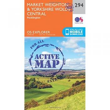
Explore the rolling hills of Market Weighton and the Yorkshire Wolds with this waterproof OS Explorer Active Map 294. Ideal for hikers, adventurers, and locals seeking accurate terrain details in one compact, durable edition.

Discover the rugged beauty of Scotland’s Inner Hebrides with OS Explorer Active Map 397 – a waterproof, detailed guide to Rùm, Eigg, Muck, Canna & Sanday, perfect for hikers, campers and island explorers.

Explore the historic streets and waterways of Edinburgh, Musselburgh, and Queensferry with this waterproof Ordnance Survey Explorer 350 map. Ideal for hikers, cyclists, and locals seeking detailed topography and navigation.

Explore the vibrant coast of Blackpool and the historic charm of Preston with this waterproof OS Explorer Active Map 286, perfect for hikers, cyclists, and travel enthusiasts seeking reliable navigation.

Explore Chelmsford & The Rodings with OS Explorer Active 183 – a durable, waterproof map featuring detailed topography, walking routes, and digital version options for hikers and locals alike.

Explore the rugged beauty of North Wales with the Ordnance Survey Explorer Active Map 265 covering Clwydian Range, Prestatyn, Mold & Ruthin. Waterproof, detailed topography for hikers, cyclists, and outdoor enthusiasts.

Explore the heart of Shropshire with the Ordnance Survey OS Explorer 240 map of Oswestry and surrounding villages—Chirk, Ellesmere, Pant, Croesoswallt. Waterproof, durable paper or digital version available for hikers, cyclists, and history lovers.

Explore the rugged beauty of Teviotdale South with this waterproof Ordnance Survey Explorer Active Map 331 – a detailed, durable guide for hikers and history lovers alike. Perfect for field use or home reference.

Explore the Scottish Borders with OS Landranger Active Map 73 – waterproof, weather‑proof, and perfect for walking, cycling or day trips around Peebles, Galashiels, Selkirk & the Tweed Valley.

Explore the coastline and countryside of Blackpool and Preston with OS Explorer Map 286 – a detailed paper map featuring Lytham St Annes and Leyland, perfect for hikers, cyclists, and local explorers.

Explore the historic heart of March & Ely with OS Explorer Active Map 228 – waterproof, detailed, and perfect for walking, cycling or hiking across Chatteris, Littleport, Welney and Denver Sluice. Find it in stores today.

Explore the heart of England’s greenest woodland with the Ordnance Survey Explorer 245 map. Detail-rich, accurate topography of The National Forest – perfect for hikers, cyclists and nature lovers.

Explore the UK's lush landscapes with this weather‑proof Ordnance Survey Explorer map of The National Forest—perfect for hikers, cyclists and nature lovers seeking accurate, durable navigation.

Explore the rugged beauty of Ben Wyvis and Strathpeffer with this detailed Ordnance Survey Explorer Active map (437). Perfect for hikers, featuring weather‑resistant paper, digital version, and precise topography of Scotland’s Highlands.

Explore the beautiful valleys of Wales with OS Explorer Active Map 187 – featuring Llandovery, Llanwrtyd Wells and Llyn Brianne. Waterproof, durable, and ideal for hikers, cyclists, and outdoor enthusiasts seeking reliable navigation.

Explore the rolling hills of Blairgowrie and the ancient Forest of Alyth with this waterproof Ordnance Survey Landranger Active Map 53 – ideal for hikers, cyclists, and nature lovers seeking accurate navigation in Scotland’s beautiful countryside.

Explore South East Lewis with the OS Explorer Active Map 457 – waterproof, detailed and ready for hikers, anglers, and adventure seekers looking to navigate Loch Eireas and the Shiant Islands.
Filters